Brand: Garmin
Garmin Navionics+ NSSA011R South America (North) Marine Chart
Garmin Navionics+ NSSA011R South America (North) Marine Chart
Regular price
$145.43
Regular price
Sale price
$145.43
Shipping calculated at checkout.
Sold out
About this product
The Garmin Navionics+ NSSA011R South America (North) marine chart provides comprehensive coastal and inland mapping for compatible Garmin chartplotters. This all-in-one solution features a high-detail color palette, allowing boaters to navigate with confidence using integrated Garmin and Navionics content.
- Format: microSD/SD card
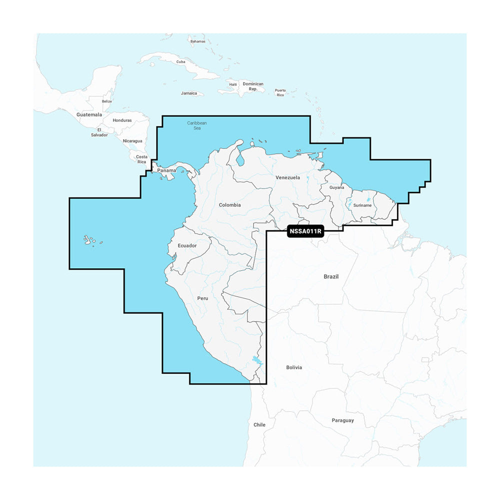
- Coverage Area: Entire coast of Panama (including the Canal), plus coastal coverage of Peru, Ecuador, Colombia, Venezuela, Trinidad and Tobago, Guyana, Suriname, and French Guiana
- Auto Guidance+ Technology: Calculates suggested dock-to-dock routing through channels, inlets, and marinas
- Depth Features: Includes up to 1' contours for detailed bottom structure, user-defined shallow water shading, and up to 10 customizable color-shaded target depth ranges
- Daily Updates: Includes a one-year subscription for daily chart updates and new content downloads via the ActiveCaptain app
- Community Content: Access to ActiveCaptain community-sourced POIs, including marinas, anchorages, and local hazards
Regulatory note: Auto Guidance+ is for planning purposes only and does not replace safe navigation operations.
Manuals & videos
Quantity
- Secure checkout
- 21-day return requests
- Free standard shipping $100+
Product facts
- CT SKU
- CT-114376
- Model / MPN
- 010-C1452-20
- UPC / GTIN
- 753759320607
- Package dimensions (H × W × L)
- 1" X 5" X 6"
- Package weight
- 0.8 lb
- Country of origin
- UNITED STATES
Shipping & returns
Shipping & returns
Request an eligible return within 21 calendar days after delivery. Every physical return requires written approval and an RMA number and must be shipped within five business days after the RMA is issued. The customer pays return shipping for an ordinary return. Tug & Tow provides prepaid return shipping for a verified damaged, defective, short, or incorrect shipment. We do not charge a restocking fee. See Shipping & Returns for eligibility, exclusions, and details.
Fit & compatibility
Fit & compatibility
Review the product title, description, images, dimensions, part numbers, and manufacturer details before purchase. For fit-sensitive items, confirm compatibility with your boat, RV, trailer, vehicle, or equipment.
Need help choosing?
Need help choosing?
Send us the product link or SKU, plus details about your boat, RV, trailer, vehicle, or project. We will help you narrow down the right option when product fit is not obvious.