Brand: Garmin
Garmin Navionics+ NSUS013R Canada, West & Alaska Mapping Card
Garmin Navionics+ NSUS013R Canada, West & Alaska Mapping Card
Sold out
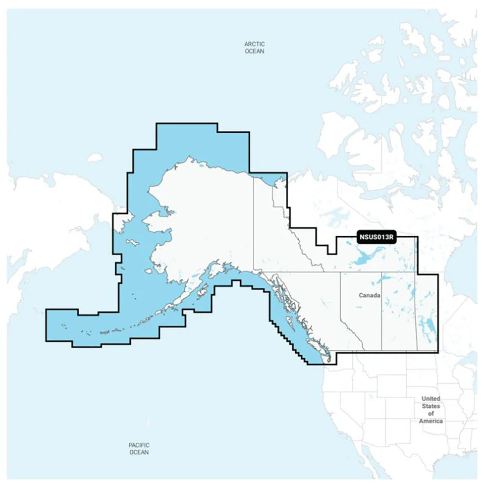
Garmin Navionics+ NSUS013R provides comprehensive coastal and inland marine mapping for western Canada and Alaska, including Vancouver Island, Puget Sound, and the Aleutian Islands. Designed for compatibility with Garmin chartplotters, this all-in-one solution integrates detailed coastal features, lakes, and rivers with a familiar Navionics color palette.
- Format: microSD/SD card
- Coverage includes detailed coastal and inland waterways of western Canada and Alaska
- Provides up to 1' contours for detailed bottom structure depiction
- Auto Guidance+ technology offers suggested dock-to-dock routing for channels, inlets, and marinas
- Depth range shading allows users to select up to 10 target depth ranges
- Shallow water shading feature helps identify hazards at user-defined depths
- Includes a one-year subscription for daily chart updates via the ActiveCaptain smart-device app
- Access community-sourced points of interest, including marinas, anchorages, and local hazards
- Customizable chart layers and overlay combinations
Regulatory note: Auto Guidance+ is intended for planning purposes only and does not replace safe navigation practices. Manufacturer part number: 010-C1485-20.
Product facts
- CT SKU
- CT-113930
- Model / MPN
- 010-C1485-20
- Package dimensions
- 1" X 4" X 6"
- Package weight
- 0.2 lb
Shipping & returns
Shipping & returns
Shipping methods, delivery estimates, and final costs appear at checkout before payment. Some bulky, supplier-shipped, or special-handling items may ship separately. See Shipping & Returns for return windows and eligibility.
Fit & compatibility
Fit & compatibility
Review the product title, description, images, dimensions, part numbers, and manufacturer details before purchase. For fit-sensitive items, confirm compatibility with your boat, RV, trailer, vehicle, or equipment.
Need help choosing?
Need help choosing?
Send us the product link or SKU, plus details about your boat, RV, trailer, vehicle, or project. We will help you narrow down the right option when product fit is not obvious.