Brand: Garmin
Garmin Navionics Vision+ NVUS012R Canada, East & Great Lakes Mapping Card
Garmin Navionics Vision+ NVUS012R Canada, East & Great Lakes Mapping Card
Sold out
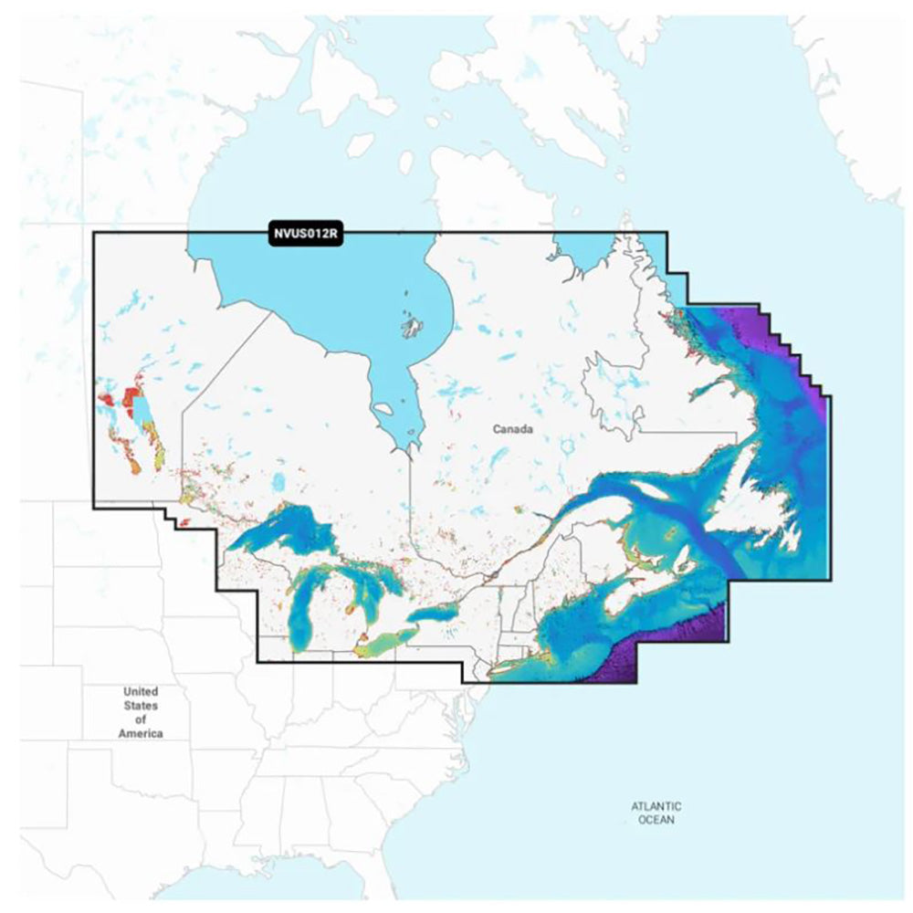
The Garmin Navionics Vision+ NVUS012R provides comprehensive marine cartography for Eastern Canada and the Great Lakes. This all-in-one mapping solution combines coastal and inland data to help boaters navigate channels, harbors, and waterways with precision on compatible Garmin chartplotters.
Key Features:
- Coverage includes coastal and inland waterways of Eastern Canada, the Great Lakes, St. Lawrence River, Maritime Provinces, and the Grand Banks.
- Delivered on a microSD/SD memory card.
- Includes a one-year subscription for daily chart updates and access to downloadable premium content via the ActiveCaptain app.
- Auto Guidance+ technology provides suggested dock-to-dock routing.
- High-resolution depth range shading with up to 10 user-selectable color options.
- Detailed bottom contours down to 1 ft. for improved navigation and fishing.
- Premium features include high-resolution relief shading, high-resolution satellite imagery, aerial photography, and 3D perspectives (Fisheye and Marinereye).
- Shallow water shading and dynamic lake level adjustment to monitor accessibility.
- ActiveCaptain community integration for POIs and local boater recommendations.
Note: Auto Guidance+ is intended for planning purposes only and does not replace safe navigation practices.
Product facts
- CT SKU
- CT-114548
- Model / MPN
- 010-C1484-00
- Package dimensions
- 1" X 4" X 6"
- Package weight
- 0.15 lb
Shipping & returns
Shipping & returns
Shipping methods, delivery estimates, and final costs appear at checkout before payment. Some bulky, supplier-shipped, or special-handling items may ship separately. See Shipping & Returns for return windows and eligibility.
Fit & compatibility
Fit & compatibility
Review the product title, description, images, dimensions, part numbers, and manufacturer details before purchase. For fit-sensitive items, confirm compatibility with your boat, RV, trailer, vehicle, or equipment.
Need help choosing?
Need help choosing?
Send us the product link or SKU, plus details about your boat, RV, trailer, vehicle, or project. We will help you narrow down the right option when product fit is not obvious.