Brand: Garmin
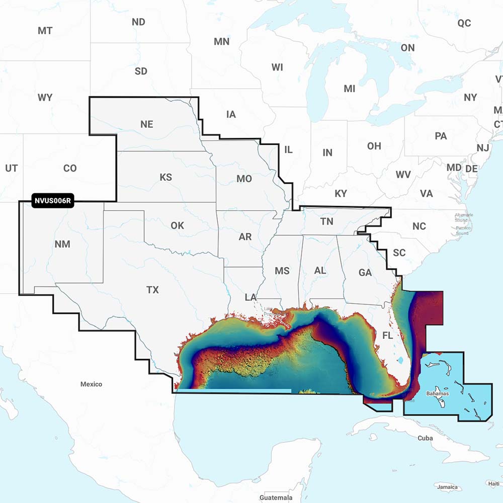
Garmin Navionics Vision+ NVUS006R U.S. South Marine Mapping Card
Garmin Navionics Vision+ NVUS006R U.S. South Marine Mapping Card
Sold out
The Garmin Navionics Vision+ NVUS006R U.S. South is an all-in-one marine mapping solution providing detailed coverage of coastal waters, lakes, and rivers. This cartography card integrates Garmin and Navionics content, offering high-resolution bathymetry and advanced navigation features for compatible chartplotters.
Key Features:
- Includes SonarChart 1’ (0.5 meter) HD bathymetry maps for detailed bottom structure depiction.
- Supports dock-to-dock route guidance technology for planning paths through channels and inlets.
- Enables SonarChart Live mapping to create personal, real-time 1’ HD bathymetry maps while navigating.
- Features customizable fishing range highlighting and shallow water shading to assist in navigation and identifying fishing spots.
- Provides wireless access to daily chart updates via the Plotter Sync feature and the Navionics Boating app.
- Includes one year of renewable subscription updates for fresh chart data.
- Allows viewing of Community Edits content layer from Navionics Boating app users.
- Supplied on a microSD card.
Compatibility: This mapping software is compatible with Echomap UHD (7/9), Echomap Ultra (10/12), GPSmap 10X2/12X2, GPSmap 12X2 Touch, GPSmap 7X2/9X2/12X2 Plus, GPSmap 7X3/9X3/12X3, GPSmap 8400/8600, and GPSmap 8700 Black Box series. Manufacturer Part Number: 010-C1290-00. Note: Route guidance is for planning purposes only and does not replace safe navigation practices.
Product facts
- CT SKU
- CT-110657
- Model / MPN
- 010-C1290-00
- UPC / GTIN
- 753759290641
- Package dimensions
- 1" X 4" X 6"
- Package weight
- 0.15 lb
Shipping & returns
Shipping & returns
Shipping methods, delivery estimates, and final costs appear at checkout before payment. Some bulky, supplier-shipped, or special-handling items may ship separately. See Shipping & Returns for return windows and eligibility.
Fit & compatibility
Fit & compatibility
Review the product title, description, images, dimensions, part numbers, and manufacturer details before purchase. For fit-sensitive items, confirm compatibility with your boat, RV, trailer, vehicle, or equipment.
Need help choosing?
Need help choosing?
Send us the product link or SKU, plus details about your boat, RV, trailer, vehicle, or project. We will help you narrow down the right option when product fit is not obvious.