Brand: Garmin
Garmin LakeVü g3 Ultra U.S. West Map Card (010-C1205-00)
Garmin LakeVü g3 Ultra U.S. West Map Card (010-C1205-00)
Sold out
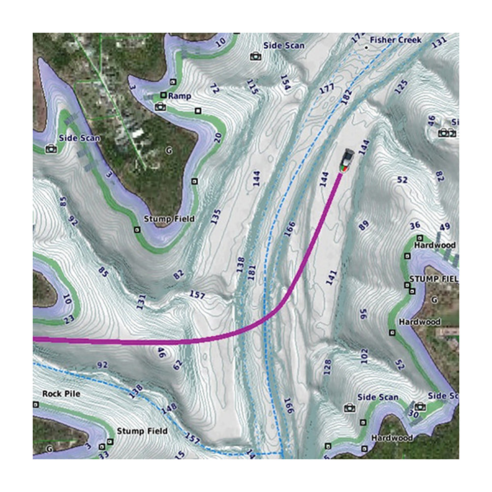
The Garmin LakeVü g3 Ultra U.S. West map provides detailed freshwater navigation and fishing data for over 17,000 lakes. This card integrates Garmin and Navionics data to offer superior coverage, clarity, and precision for inland waters.
- Coverage includes over 5,900 HD lakes with up to 1' contours and more than 75 Garmin Elite survey lakes.
- Auto Guidance technology calculates suggested navigation paths based on your desired depth and overhead clearance.
- High-resolution relief shading combines color and shadow to provide an clear visual representation of bottom structure.
- Depth Range Shading allows for up to 10 distinct ranges to help you identify target depths quickly.
- Shallow Water Shading enables you to highlight specific depth limits to avoid.
- Dynamic Lake Level adjustment aligns maps to current water levels to identify accessible spots.
- Provides MarinerEye and FishEye 3-D views for perspectives both above and below the water line.
Regulatory note: This product can expose you to chemicals known to the State of California to cause cancer, birth defects, or other reproductive harm. For more information, visit P65Warnings.ca.gov.
Auto Guidance is for planning purposes only and does not replace safe navigation operations.
Product facts
- CT SKU
- CT-113915
- Model / MPN
- 010-C1205-00
- UPC / GTIN
- 753759228057
- Package dimensions
- " X 5" X 5"
- Package weight
- 0.05 lb
Shipping & returns
Shipping & returns
Shipping methods, delivery estimates, and final costs appear at checkout before payment. Some bulky, supplier-shipped, or special-handling items may ship separately. See Shipping & Returns for return windows and eligibility.
Fit & compatibility
Fit & compatibility
Review the product title, description, images, dimensions, part numbers, and manufacturer details before purchase. For fit-sensitive items, confirm compatibility with your boat, RV, trailer, vehicle, or equipment.
Need help choosing?
Need help choosing?
Send us the product link or SKU, plus details about your boat, RV, trailer, vehicle, or project. We will help you narrow down the right option when product fit is not obvious.