Brand: Garmin
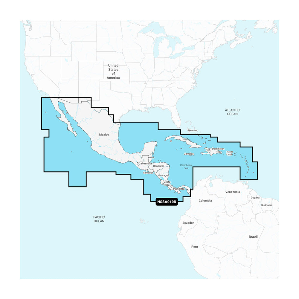
Garmin Navionics+ NSSA010R Central America & Caribbean Marine Chart
Garmin Navionics+ NSSA010R Central America & Caribbean Marine Chart
4 available
The Garmin Navionics+ NSSA010R Central America & Caribbean chart offers comprehensive coastal and inland mapping for compatible Garmin chartplotters. This all-in-one solution features a streamlined interface, vibrant colors, and the trusted Navionics style color palette to assist with navigation and course planning.
- Format: microSD/SD card
- Coverage includes the west coast of Mexico (Tijuana to Panama), Panama Canal, East Coast (Panama to Brownsville, TX), and the Caribbean (including Bahamas, Cuba, Jamaica, Haiti, Dominican Republic, Puerto Rico, and Lesser Antilles to Grenada)
- Auto Guidance+ technology provides suggested dock-to-dock routing through channels and inlets
- Includes up to 1' contours for detailed bottom structure depiction in harbors, marinas, and inland waters
- Features high-resolution depth range shading with up to 10 customizable targets
- Shallow water shading allows for user-defined depth visualization to assist with hazard avoidance
- Includes a one-year subscription for daily chart updates and new content downloads via the ActiveCaptain smart-device app
- Access the ActiveCaptain community for user-sourced POIs such as marinas, anchorages, and hazards
Note: Auto Guidance+ is for planning purposes only and does not replace safe navigation. NOAA raster cartography is available as a free download for select U.S. waters via the ActiveCaptain app, though it cannot be viewed directly on ECHOMAP CHIRP and ECHOMAP Plus combinations.
Product facts
- CT SKU
- CT-114375
- Model / MPN
- 010-C1451-20
- UPC / GTIN
- 753759320591
- Package dimensions
- 1" X 4" X 6"
- Package weight
- 0.17 lb
Shipping & returns
Shipping & returns
Shipping methods, delivery estimates, and final costs appear at checkout before payment. Some bulky, supplier-shipped, or special-handling items may ship separately. See Shipping & Returns for return windows and eligibility.
Fit & compatibility
Fit & compatibility
Review the product title, description, images, dimensions, part numbers, and manufacturer details before purchase. For fit-sensitive items, confirm compatibility with your boat, RV, trailer, vehicle, or equipment.
Need help choosing?
Need help choosing?
Send us the product link or SKU, plus details about your boat, RV, trailer, vehicle, or project. We will help you narrow down the right option when product fit is not obvious.