Brand: Garmin
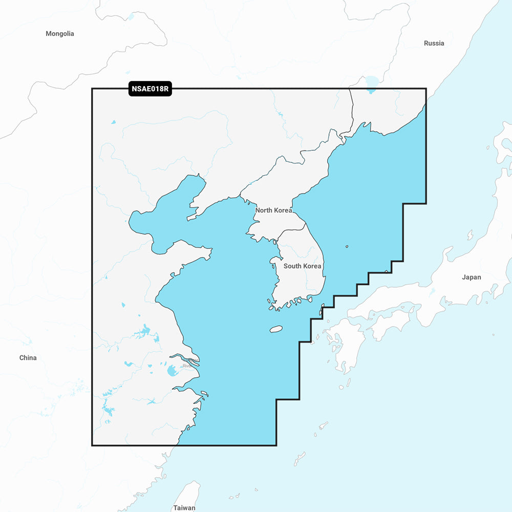
Garmin Navionics+ Marine Chart - Yellow Sea (NSAE018R)
Garmin Navionics+ Marine Chart - Yellow Sea (NSAE018R)
Sold out
The Garmin Navionics+ NSAE018R marine chart provides detailed coastal and inland mapping for the Yellow Sea. Designed for compatible GPS chartplotters, this all-in-one map solution features a familiar Navionics color palette and intuitive interface to assist with navigation and route planning.
Coverage Area:
Includes the East Asian coast from Vladivostok, Russia, to Shanghai, China, encompassing the Korean Peninsula and major ports such as Busan and Dalian.
Key Features:
- Auto Guidance+ technology for suggested dock-to-dock routing through channels and inlets.
- High-resolution depth range shading with up to 10 customizable target depth ranges.
- Detailed bottom structure depiction with up to 1' contours for enhanced navigation.
- Shallow water shading to assist in identifying and avoiding hazards at user-defined depths.
- Access to the ActiveCaptain community for POI recommendations and local boater insights.
- Includes a one-year subscription for daily chart updates via the ActiveCaptain app.
Technical Specifications:
- Format: MicroSD/SD card.
- Chart Code: NSAE018R.
- Note: Auto Guidance+ is intended for planning purposes only and does not replace safe navigation practices. Please verify chartplotter compatibility prior to purchase.
Product facts
- CT SKU
- CT-111685
- Model / MPN
- 010-C1216-20
- Package dimensions
- 1" X 1" X 6"
- Package weight
- 0.1 lb
Shipping & returns
Shipping & returns
Shipping methods, delivery estimates, and final costs appear at checkout before payment. Some bulky, supplier-shipped, or special-handling items may ship separately. See Shipping & Returns for return windows and eligibility.
Fit & compatibility
Fit & compatibility
Review the product title, description, images, dimensions, part numbers, and manufacturer details before purchase. For fit-sensitive items, confirm compatibility with your boat, RV, trailer, vehicle, or equipment.
Need help choosing?
Need help choosing?
Send us the product link or SKU, plus details about your boat, RV, trailer, vehicle, or project. We will help you narrow down the right option when product fit is not obvious.