Brand: Garmin
Garmin Navionics+ NSEU008R Bay of Biscay Marine Chart
Garmin Navionics+ NSEU008R Bay of Biscay Marine Chart
Sold out
The Garmin Navionics+ NSEU008R is a detailed marine chart for the Bay of Biscay, offering comprehensive coastal and inland mapping for compatible GPS chartplotters. This all-in-one solution provides up-to-date navigation data and advanced features for improved situational awareness on the water.
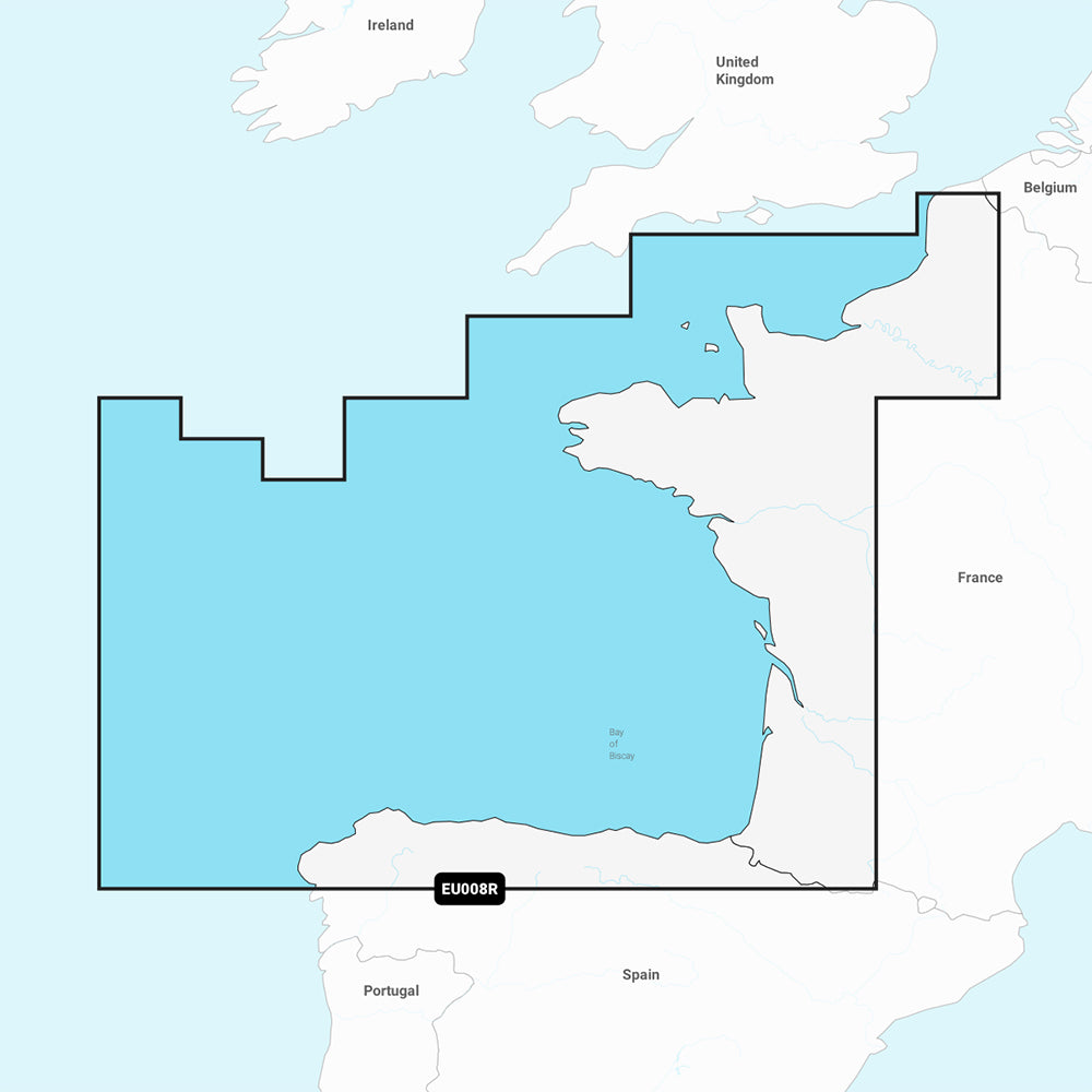
Coverage Area:
This chart covers the Atlantic coast of Europe, extending from Dunkirk, France, to A Coruna, Spain. Coverage includes the Channel Islands and major ports such as Le Havre, Brest, Nantes, Saint-Nazaire, and Bordeaux in France, as well as Bilbao and Gijon in Spain.
Key Features:
- Includes a one-year subscription for daily chart updates via the ActiveCaptain app.
- Auto Guidance+ technology suggests dock-to-dock paths through channels, inlets, and marinas.
- High-resolution depth range shading with up to 10 user-selected color-shaded target depth ranges.
- Contours as detailed as 1' for clear depiction of bottom structure.
- Shallow water shading at a user-defined depth to aid navigation.
- Access to ActiveCaptain community-sourced content including POIs, marinas, and hazards.
Technical Specifications:
- Format: MicroSD/SD card.
- Chart Code: NSEU008R.
- Manufacturer Part Number: 010-C1235-20.
Note: Auto Guidance+ is for planning purposes only and does not replace safe navigation operations. Please verify the compatibility of your specific GPS chartplotter model with Garmin Navionics+ content before use.
Product facts
- CT SKU
- CT-111702
- Model / MPN
- 010-C1235-20
- Package dimensions
- 1" X 4" X 4"
- Package weight
- 1.0 lb
Shipping & returns
Shipping & returns
Shipping methods, delivery estimates, and final costs appear at checkout before payment. Some bulky, supplier-shipped, or special-handling items may ship separately. See Shipping & Returns for return windows and eligibility.
Fit & compatibility
Fit & compatibility
Review the product title, description, images, dimensions, part numbers, and manufacturer details before purchase. For fit-sensitive items, confirm compatibility with your boat, RV, trailer, vehicle, or equipment.
Need help choosing?
Need help choosing?
Send us the product link or SKU, plus details about your boat, RV, trailer, vehicle, or project. We will help you narrow down the right option when product fit is not obvious.