Brand: Garmin
Garmin Navionics+ Marine Chart - Mediterranean Sea, Central West (NSEU012R)
Garmin Navionics+ Marine Chart - Mediterranean Sea, Central West (NSEU012R)
Sold out
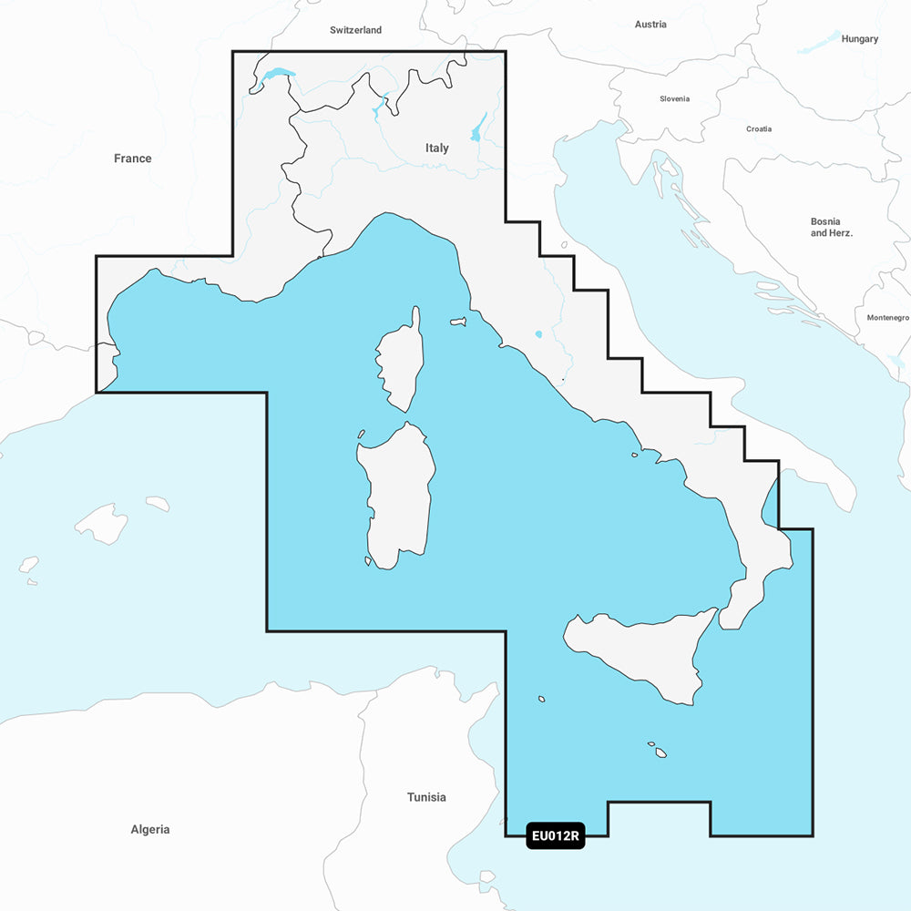
This Garmin Navionics+ marine chart (NSEU012R) provides detailed coastal and inland mapping for the Central West Mediterranean Sea, covering the area from L'Esartit, Spain to Crotone, Italy. The region includes Corsica, Sardinia, Sicily, and Malta, as well as several major northern Italian lakes including Lago di Garda and Lago di Como.
Key Features:
- All-in-one mapping for coastal features, lakes, and rivers with high-resolution 1' depth contours.
- Built-in Auto Guidance+ technology for dock-to-dock routing suggestions.
- Customizable depth range shading with up to 10 color-shaded ranges.
- Shallow water shading to assist in navigation.
- Access to daily chart updates via the ActiveCaptain app with the included one-year subscription.
- Integration with ActiveCaptain community content for local POIs and boater recommendations.
Technical Specifications:
- Format: MicroSD/SD card.
- Included in box: SD/MicroSD card.
- Compatibility: Designed for compatible GPS chartplotters; please verify device compatibility prior to use.
Note: Auto Guidance+ is intended for planning purposes only and does not replace safe navigation practices.
Product facts
- CT SKU
- CT-111705
- Model / MPN
- 010-C1238-20
- Package dimensions
- 1" X 4" X 4"
- Package weight
- 1.0 lb
Shipping & returns
Shipping & returns
Shipping methods, delivery estimates, and final costs appear at checkout before payment. Some bulky, supplier-shipped, or special-handling items may ship separately. See Shipping & Returns for return windows and eligibility.
Fit & compatibility
Fit & compatibility
Review the product title, description, images, dimensions, part numbers, and manufacturer details before purchase. For fit-sensitive items, confirm compatibility with your boat, RV, trailer, vehicle, or equipment.
Need help choosing?
Need help choosing?
Send us the product link or SKU, plus details about your boat, RV, trailer, vehicle, or project. We will help you narrow down the right option when product fit is not obvious.