Brand: Garmin
Garmin Navionics+ NSEU014R Marine Chart - Italy and Adriatic Sea
Garmin Navionics+ NSEU014R Marine Chart - Italy and Adriatic Sea
Sold out
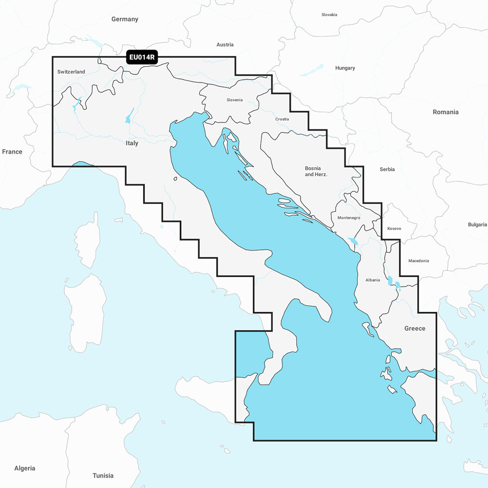
The Garmin Navionics+ NSEU014R marine chart provides detailed coastal and inland mapping for the Italy and Adriatic Sea region. This all-in-one solution features a high-resolution, color-shaded interface designed for easy navigation and precise bottom-structure identification.
- Coverage Area: Po River, Adriatic coast of Italy, Slovenia, Croatia, Albania, western coast of Greece, southern Italy, eastern Sicily, Straits of Messina, Dalmatian Coast, Gulf of Taranto, and major Italian lakes (Lago Maggiore, Lago d'Iseo, Lago di Como, Lago di Garda).
- Key Features: Includes Auto Guidance+ technology for dock-to-dock routing, high-resolution depth range shading with up to 10 customizable targets, and up to 1' contours for detailed bottom visibility.
- Updates: Includes a one-year subscription for daily chart updates accessible via the ActiveCaptain app.
- Compatibility: Compatible with specific Garmin GPS chartplotters; please verify compatibility before purchase.
- Technical Specs: Format is MicroSD/SD card.
- Included: One SD/MicroSD card.
Auto Guidance+ is intended for planning purposes only and is not a substitute for safe navigation practices.
Product facts
- CT SKU
- CT-111706
- Model / MPN
- 010-C1239-20
- Package dimensions
- 1" X 4" X 4"
- Package weight
- 1.0 lb
Shipping & returns
Shipping & returns
Shipping methods, delivery estimates, and final costs appear at checkout before payment. Some bulky, supplier-shipped, or special-handling items may ship separately. See Shipping & Returns for return windows and eligibility.
Fit & compatibility
Fit & compatibility
Review the product title, description, images, dimensions, part numbers, and manufacturer details before purchase. For fit-sensitive items, confirm compatibility with your boat, RV, trailer, vehicle, or equipment.
Need help choosing?
Need help choosing?
Send us the product link or SKU, plus details about your boat, RV, trailer, vehicle, or project. We will help you narrow down the right option when product fit is not obvious.