Brand: Garmin
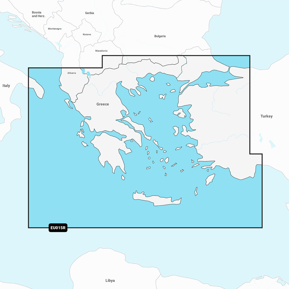
Garmin Navionics+ Marine Chart - NSEU015R - Aegean Sea and Sea of Marmara
Garmin Navionics+ Marine Chart - NSEU015R - Aegean Sea and Sea of Marmara
Sold out
The Garmin Navionics+ Marine Chart (NSEU015R) provides comprehensive, up-to-date cartography for your compatible GPS chartplotter. This all-in-one map solution features high-resolution detail and advanced navigation tools for the Aegean Sea, the Sea of Marmara, the Dardanelles, and Crete, including the ports of Athens, Istanbul, and Antalya.
Key Features:
- Coverage includes all of Greece, the Aegean coast of Turkey, and the Sea of Marmara.
- Includes a one-year subscription for daily chart updates accessible via the ActiveCaptain app.
- Auto Guidance+ technology provides suggested dock-to-dock routing through channels and marinas.
- High-detail mapping with up to 1' contours for improved bottom structure visibility.
- Depth range shading allows for up to 10 user-defined, color-shaded target depth ranges.
- Shallow water shading helps identify depth-specific hazards.
- ActiveCaptain Community integration for user-sourced POIs and local navigation recommendations.
- Format: MicroSD/SD card.
Note: Auto Guidance+ is intended for planning purposes only and is not a substitute for safe navigation. Please verify compatibility with your specific GPS chartplotter before use.
Product facts
- CT SKU
- CT-111707
- Model / MPN
- 010-C1240-20
- Package dimensions
- 1" X 4" X 4"
- Package weight
- 1.0 lb
Shipping & returns
Shipping & returns
Shipping methods, delivery estimates, and final costs appear at checkout before payment. Some bulky, supplier-shipped, or special-handling items may ship separately. See Shipping & Returns for return windows and eligibility.
Fit & compatibility
Fit & compatibility
Review the product title, description, images, dimensions, part numbers, and manufacturer details before purchase. For fit-sensitive items, confirm compatibility with your boat, RV, trailer, vehicle, or equipment.
Need help choosing?
Need help choosing?
Send us the product link or SKU, plus details about your boat, RV, trailer, vehicle, or project. We will help you narrow down the right option when product fit is not obvious.