Brand: Garmin
Garmin Navionics+ NSEU016R Southeast Mediterranean Sea Marine Chart
Garmin Navionics+ NSEU016R Southeast Mediterranean Sea Marine Chart
Sold out
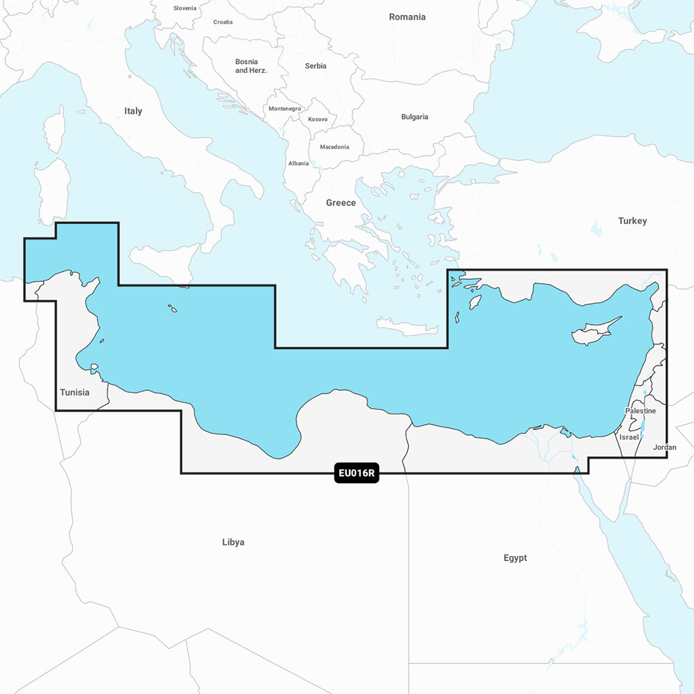
The Garmin Navionics+ NSEU016R provides detailed marine mapping for the southeastern Mediterranean Sea, covering the coastline from Tunis, Tunisia, to Antalya, Turkey. This includes the Levant, Suez Canal, Cyprus, and Malta, with coverage for major ports such as Tripoli, Alexandria, Port Said, and Beirut.
Key Features:
- Includes a one-year subscription for daily chart updates via the ActiveCaptain app.
- Features Auto Guidance+ technology for suggested dock-to-dock routing.
- Provides high-resolution depth range shading with up to 10 customizable target depth ranges.
- Includes up to 1' contours for detailed bottom structure identification.
- Offers shallow water shading for enhanced navigation safety.
- Accesses the ActiveCaptain community for user-contributed POIs and local insights.
- Format: MicroSD/SD card.
Note: Auto Guidance+ is intended for planning purposes only and does not replace safe navigation operations. Please verify the compatibility of your GPS chartplotter before use.
Product facts
- CT SKU
- CT-111708
- Model / MPN
- 010-C1241-20
- Package dimensions
- 1" X 4" X 4"
- Package weight
- 1.0 lb
Shipping & returns
Shipping & returns
Shipping methods, delivery estimates, and final costs appear at checkout before payment. Some bulky, supplier-shipped, or special-handling items may ship separately. See Shipping & Returns for return windows and eligibility.
Fit & compatibility
Fit & compatibility
Review the product title, description, images, dimensions, part numbers, and manufacturer details before purchase. For fit-sensitive items, confirm compatibility with your boat, RV, trailer, vehicle, or equipment.
Need help choosing?
Need help choosing?
Send us the product link or SKU, plus details about your boat, RV, trailer, vehicle, or project. We will help you narrow down the right option when product fit is not obvious.