Brand: Garmin
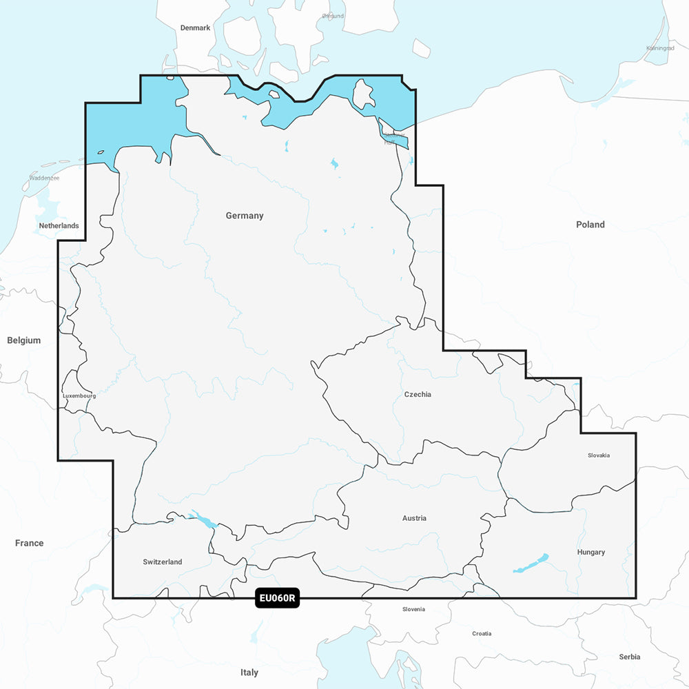
Garmin Navionics+ NSEU060R Germany Lakes and Rivers Marine Chart
Garmin Navionics+ NSEU060R Germany Lakes and Rivers Marine Chart
Sold out
The Garmin Navionics+ NSEU060R provides detailed marine and inland mapping for the German North Sea, Baltic coast, and the extensive German inland waterway system. This all-in-one cartography solution features integrated Garmin and Navionics content, offering precise navigation details for rivers, lakes, and coastal areas.
Key Features:
- Detailed coverage of the Rhine, Main, Danube, Saar, Moselle, Ems, Weser, Elbe, Vltava, and Havel rivers, plus the Rhine-Main-Danube, Oder-Havel, Elbe-Havel, Elbe-Seiten, and Mittelland canals.
- Includes major lakes such as Lake Constance, Lake Zurich, Lake Balaton, Chiemsee, Attersee, and Neusiedler See.
- Auto Guidance+ technology provides suggested dock-to-dock routing.
- High-resolution 1' contours for improved awareness of bottom structures.
- Depth range shading allows for up to 10 user-defined color-shaded target depth ranges.
- Shallow water shading to assist in identifying depth hazards.
- Access to the ActiveCaptain community for user-contributed POIs and local recommendations.
- Includes a one-year subscription for daily chart updates via the ActiveCaptain app.
Technical Specifications:
- Part Number: 010-C1255-20
- Format: MicroSD/SD card
- Auto Guidance+ is intended for planning purposes only and does not replace safe navigation practices.
Product facts
- CT SKU
- CT-111722
- Model / MPN
- 010-C1255-20
- Package dimensions
- 1" X 4" X 4"
- Package weight
- 1.0 lb
Shipping & returns
Shipping & returns
Shipping methods, delivery estimates, and final costs appear at checkout before payment. Some bulky, supplier-shipped, or special-handling items may ship separately. See Shipping & Returns for return windows and eligibility.
Fit & compatibility
Fit & compatibility
Review the product title, description, images, dimensions, part numbers, and manufacturer details before purchase. For fit-sensitive items, confirm compatibility with your boat, RV, trailer, vehicle, or equipment.
Need help choosing?
Need help choosing?
Send us the product link or SKU, plus details about your boat, RV, trailer, vehicle, or project. We will help you narrow down the right option when product fit is not obvious.