Brand: Garmin
Garmin Navionics+ NSEU079R Marine Chart - Southeast Sweden
Garmin Navionics+ NSEU079R Marine Chart - Southeast Sweden
Sold out
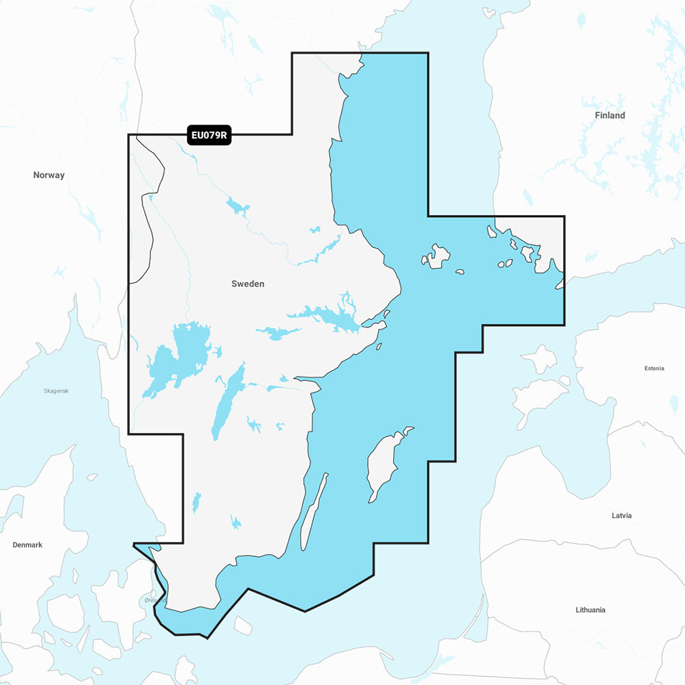
The Garmin Navionics+ NSEU079R marine chart provides detailed, up-to-date cartography for Southeast Sweden and surrounding waters. This all-in-one map solution integrates coastal and inland data to assist with navigation and trip planning on compatible chartplotters.
Coverage Area:
- Includes the south and east coasts of Sweden from Helsingborg to Sundsvall, featuring major areas such as Trelleborg, Nykoping, Stockholm, Norrtalje, and Karlsborg.
- Covers the southwest tip of Finland, including Turku.
- Includes islands of Oland, Gotland, and Aland.
- Covers lakes including Vanern, Vattern, Sommen, Siljan, Runn, Fryken, and Helgasjon, as well as the Gota Kanal, Stromsholms Kanal, and lower Dalalven.
Key Features:
- Includes a one-year subscription for daily chart updates via the ActiveCaptain app.
- Auto Guidance+ technology provides suggested dock-to-dock routing paths.
- High-resolution 1 ft. contours provide detailed bottom structure mapping.
- Depth range shading allows for up to 10 customizable, color-shaded target depth ranges.
- Shallow water shading helps identify navigation hazards at user-defined depths.
- Integrates community-sourced content from the ActiveCaptain community for local POIs and recommendations.
Specifications:
- Format: MicroSD/SD card included.
- Model: NSEU079R (010-C1247-20).
Auto Guidance+ is for planning purposes only and does not replace safe navigation operations. Please verify compatibility with your specific GPS chartplotter before use.
Product facts
- CT SKU
- CT-111714
- Model / MPN
- 010-C1247-20
- Package dimensions
- 1" X 4" X 4"
- Package weight
- 1.0 lb
Shipping & returns
Shipping & returns
Shipping methods, delivery estimates, and final costs appear at checkout before payment. Some bulky, supplier-shipped, or special-handling items may ship separately. See Shipping & Returns for return windows and eligibility.
Fit & compatibility
Fit & compatibility
Review the product title, description, images, dimensions, part numbers, and manufacturer details before purchase. For fit-sensitive items, confirm compatibility with your boat, RV, trailer, vehicle, or equipment.
Need help choosing?
Need help choosing?
Send us the product link or SKU, plus details about your boat, RV, trailer, vehicle, or project. We will help you narrow down the right option when product fit is not obvious.