Brand: Garmin
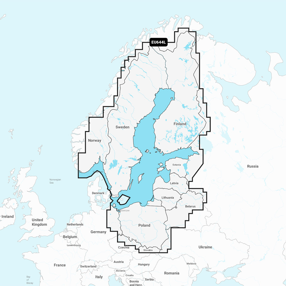
Garmin Navionics+ Baltic Sea Marine Chart (NSEU644L)
Garmin Navionics+ Baltic Sea Marine Chart (NSEU644L)
Sold out
The Garmin Navionics+ Baltic Sea Marine Chart (NSEU644L) provides detailed, up-to-date cartography for compatible GPS chartplotters. This all-in-one mapping solution covers coastal waters, lakes, and rivers, including the Gulfs of Bothnia, Finland, and Riga, as well as major lakes across Scandinavia and Poland.
Key Features:
- Up-to-date mapping with access to daily chart updates for one year via the ActiveCaptain app.
- Auto Guidance+ technology for suggested dock-to-dock routing.
- High-resolution depth range shading with up to 10 customizable target depth ranges.
- Detailed contours up to 1 ft. for enhanced bottom structure visibility in harbors, canals, and waterways.
- Shallow water shading to help navigate areas with specific depth requirements.
- Integrated ActiveCaptain community content, including POIs, hazards, and local recommendations.
Technical Specifications:
- Format: MicroSD/SD card.
- Included: One-year subscription for daily updates.
- Compatibility: Verify chartplotter compatibility prior to use.
Note: Auto Guidance+ is intended for planning purposes only and does not replace safe navigation practices.
Product facts
- CT SKU
- CT-111737
- Model / MPN
- 010-C1273-20
- Package dimensions
- 1" X 1" X 6"
- Package weight
- 0.1 lb
Shipping & returns
Shipping & returns
Shipping methods, delivery estimates, and final costs appear at checkout before payment. Some bulky, supplier-shipped, or special-handling items may ship separately. See Shipping & Returns for return windows and eligibility.
Fit & compatibility
Fit & compatibility
Review the product title, description, images, dimensions, part numbers, and manufacturer details before purchase. For fit-sensitive items, confirm compatibility with your boat, RV, trailer, vehicle, or equipment.
Need help choosing?
Need help choosing?
Send us the product link or SKU, plus details about your boat, RV, trailer, vehicle, or project. We will help you narrow down the right option when product fit is not obvious.