Brand: Garmin
Garmin Navionics+ Marine Chart - Skagerrak & Kattegat (NSEU645L)
Garmin Navionics+ Marine Chart - Skagerrak & Kattegat (NSEU645L)
Sold out
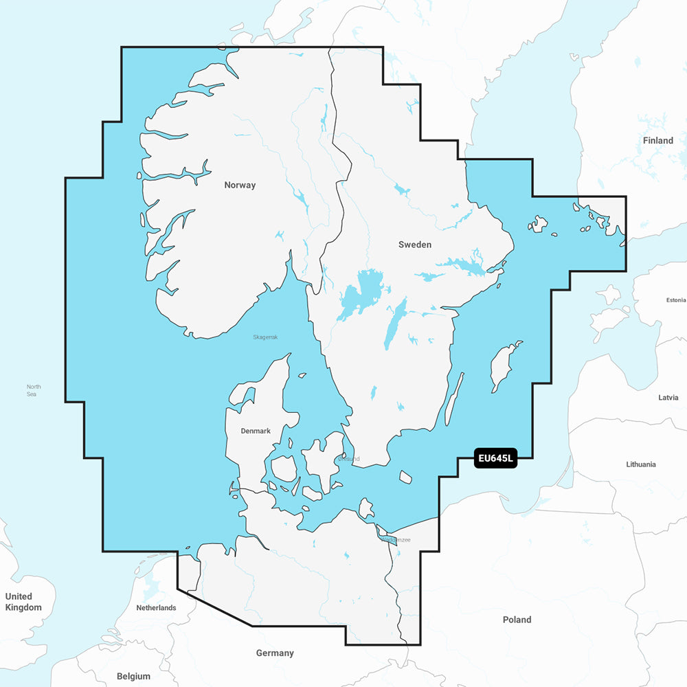
The Garmin Navionics+ NSEU645L is a comprehensive marine charting solution for compatible chartplotters, providing detailed coverage of the Skagerrak and Kattegat regions. This all-in-one map includes coastal and inland data, offering an integrated view of Scandinavian coastal waters, Denmark, and various lakes across Sweden, Norway, and Finland.
- Extensive Coverage: Includes the Scandinavian coast from Kristiansund, Norway to Gavle, Sweden; all of Denmark; and major ports including Oslo, Malmo, Stockholm, Copenhagen, Aarhus, and Hamburg.
- Advanced Navigation: Features Auto Guidance+ technology for suggested dock-to-dock routing and up to 1-foot contours for detailed bottom structure visualization.
- Customization Tools: Offers depth range shading with up to 10 user-defined color-shaded target ranges and shallow water shading to aid in navigation safety.
- ActiveCaptain Community: Access local recommendations, marinas, anchorages, and hazard reports from fellow boaters.
- Updates Included: Includes a one-year subscription for daily chart updates accessible via the ActiveCaptain app.
- Format: Supplied on a MicroSD/SD card.
Note: Auto Guidance+ is intended for planning purposes only and does not replace safe navigation practices. Please verify compatibility with your specific GPS chartplotter before use.
Product facts
- CT SKU
- CT-111738
- Model / MPN
- 010-C1274-20
- Package dimensions
- 1" X 1" X 6"
- Package weight
- 0.1 lb
Shipping & returns
Shipping & returns
Shipping methods, delivery estimates, and final costs appear at checkout before payment. Some bulky, supplier-shipped, or special-handling items may ship separately. See Shipping & Returns for return windows and eligibility.
Fit & compatibility
Fit & compatibility
Review the product title, description, images, dimensions, part numbers, and manufacturer details before purchase. For fit-sensitive items, confirm compatibility with your boat, RV, trailer, vehicle, or equipment.
Need help choosing?
Need help choosing?
Send us the product link or SKU, plus details about your boat, RV, trailer, vehicle, or project. We will help you narrow down the right option when product fit is not obvious.