Brand: Garmin
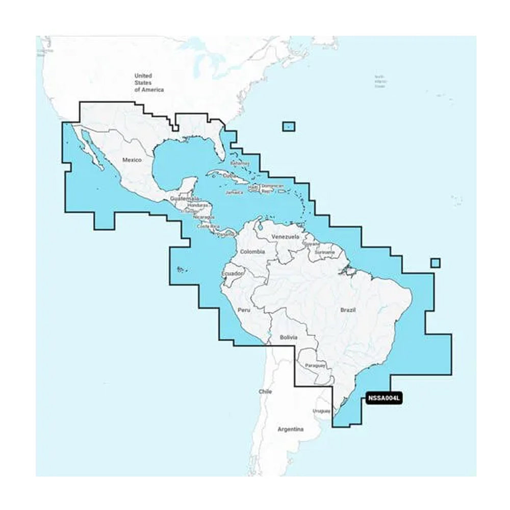
Garmin Navionics+ NSSA004L Inland & Coastal Marine Chart - Mexico, Caribbean to Brazil
Garmin Navionics+ NSSA004L Inland & Coastal Marine Chart - Mexico, Caribbean to Brazil
Sold out
The Garmin Navionics+ NSSA004L is an all-in-one marine mapping solution providing detailed coastal and inland cartography for Mexico, Central America, and Brazil. This chart offers high-resolution navigation data with advanced features designed to assist with route planning, fishing, and hazard avoidance on compatible GPS chartplotters.
Key Features:
- Coverage Area: Detailed mapping for coastal Mexico, Central America, Brazil, US Gulf Coast, US East Coast to Savannah, GA, Bermuda, the Bahamas, the Caribbean islands, the Panama Canal, western South America to Arica, Chile, and surrounding island archipelagos.
- Detailed Mapping: Provides up to 1' contours for improved bottom structure detail in harbors, canals, and marinas.
- Navigation Aids: Features integrated Auto Guidance+ technology for suggested dock-to-dock routing.
- Customization: Supports up to 10 color-shaded target depth ranges and user-defined shallow water shading.
- Updates: Includes a one-year subscription for daily chart updates accessible via the ActiveCaptain app.
- Community Content: Access to the ActiveCaptain community for user-sourced points of interest and local navigation tips.
- Format: Delivered on a MicroSD/SD card.
Note: Auto Guidance+ is for planning purposes only and does not replace safe navigation operations. Please verify your GPS chartplotter compatibility before use.
Product facts
- CT SKU
- CT-111679
- Model / MPN
- 010-C1285-20
- UPC / GTIN
- 753759289799
- Package dimensions
- 1" X 4" X 6"
- Package weight
- 0.17 lb
Shipping & returns
Shipping & returns
Shipping methods, delivery estimates, and final costs appear at checkout before payment. Some bulky, supplier-shipped, or special-handling items may ship separately. See Shipping & Returns for return windows and eligibility.
Fit & compatibility
Fit & compatibility
Review the product title, description, images, dimensions, part numbers, and manufacturer details before purchase. For fit-sensitive items, confirm compatibility with your boat, RV, trailer, vehicle, or equipment.
Need help choosing?
Need help choosing?
Send us the product link or SKU, plus details about your boat, RV, trailer, vehicle, or project. We will help you narrow down the right option when product fit is not obvious.