Brand: Garmin
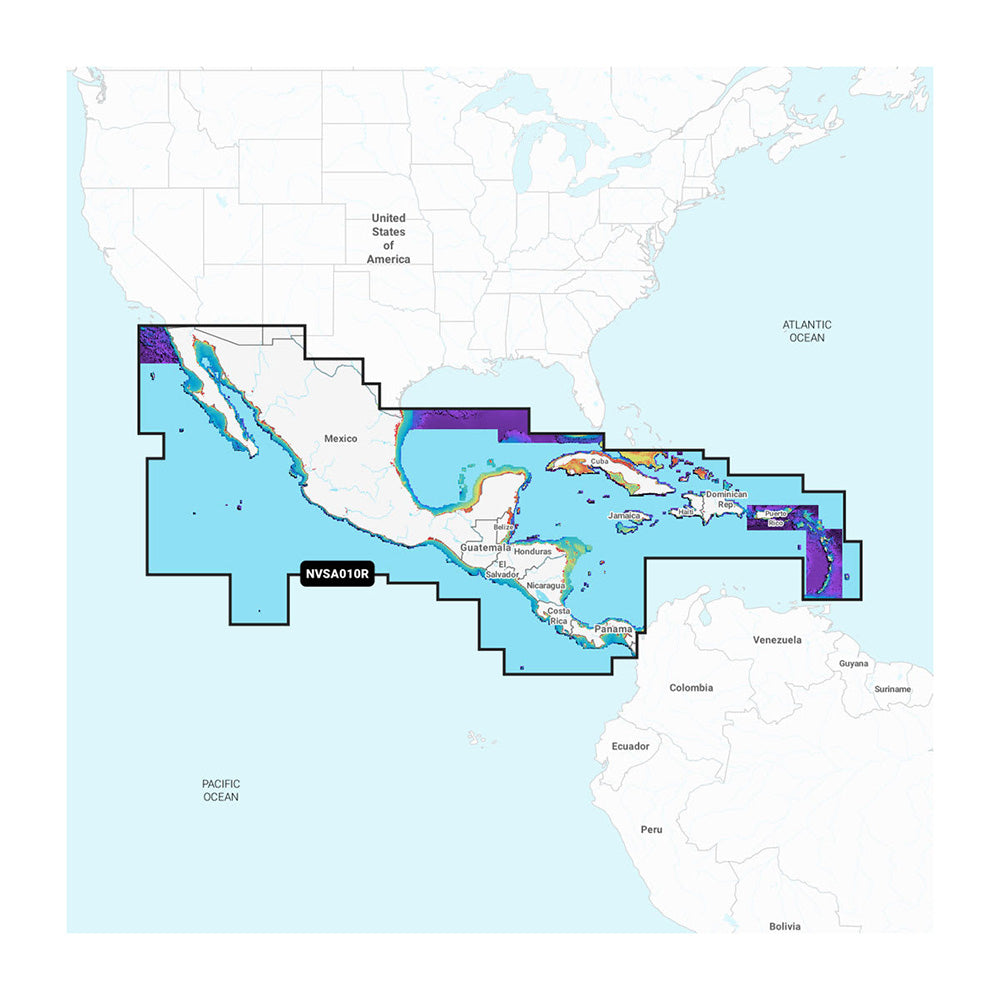
Garmin Navionics Vision+ Central America & Caribbean Mapping Card (NVSA010R)
Garmin Navionics Vision+ Central America & Caribbean Mapping Card (NVSA010R)
Last one
The Garmin Navionics Vision+ NVSA010R provides detailed marine cartography for Central America and the Caribbean, designed for use with compatible Garmin chartplotters. This all-in-one mapping solution combines offshore and inland content with a signature Navionics style color palette, offering high-resolution detail for navigation and fishing.
- Format: microSD/SD card
- Coverage: West coast of Mexico from Tijuana to Panama, Panama Canal, east coast from Panama to Brownsville, TX, and the Caribbean including Bahamas, Cuba, Jamaica, Haiti, Dominican Republic, Puerto Rico, and the Lesser Antilles
- Includes a one-year subscription for daily chart updates via the ActiveCaptain app
- Auto Guidance+ technology for suggested dock-to-dock routing
- High-resolution relief shading, sonar imagery, satellite imagery, and aerial photography (downloadable via subscription)
- Depth range shading with up to 1' contours for improved bottom structure detail
- Shallow water shading and dynamic lake level adjustments
- 3D views including Fisheye and Marinereye perspectives
- ActiveCaptain community integration for real-time POI recommendations
Note: Auto Guidance+ is intended for planning purposes only and does not replace safe navigation practices. Premium features like high-resolution relief shading, sonar imagery, and satellite imagery require an active subscription for download.
Product facts
- CT SKU
- CT-114543
- Model / MPN
- 010-C1451-00
- UPC / GTIN
- 753759320539
- Package dimensions
- 1" X 4" X 6"
- Package weight
- 0.15 lb
Shipping & returns
Shipping & returns
Shipping methods, delivery estimates, and final costs appear at checkout before payment. Some bulky, supplier-shipped, or special-handling items may ship separately. See Shipping & Returns for return windows and eligibility.
Fit & compatibility
Fit & compatibility
Review the product title, description, images, dimensions, part numbers, and manufacturer details before purchase. For fit-sensitive items, confirm compatibility with your boat, RV, trailer, vehicle, or equipment.
Need help choosing?
Need help choosing?
Send us the product link or SKU, plus details about your boat, RV, trailer, vehicle, or project. We will help you narrow down the right option when product fit is not obvious.