Brand: Garmin
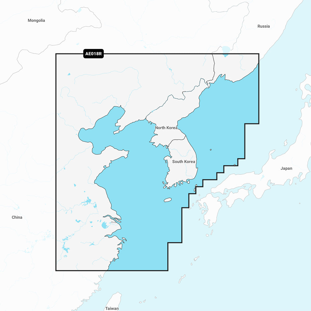
Garmin Navionics Vision+ Marine Chart NVAE018R - Yellow Sea
Garmin Navionics Vision+ Marine Chart NVAE018R - Yellow Sea
Sold out
The Garmin Navionics Vision+ NVAE018R is a premium marine chart providing detailed mapping for the Yellow Sea. This software solution includes coastal coverage of the East Asian coast from Vladivostok, Russia, to Shanghai, China, including the Korean Peninsula and the ports of Busan and Dalian.
Key Features:
- All-in-one mapping for coastal features, lakes, and rivers with high-detail contours up to 1 ft.
- Built-in Auto Guidance+ technology for suggested dock-to-dock routing.
- Advanced visual tools including high-resolution satellite imagery, aerial photography, and 3D perspectives such as Fisheye and Marinereye views.
- Customizable depth range shading with up to 10 color-shaded target ranges for identifying fishing spots and navigation hazards.
- Shallow water shading and dynamic lake level adjustments for improved situational awareness.
- Access to the ActiveCaptain community for user-sourced points of interest and recommendations.
- Includes a one-year subscription for daily chart updates via the ActiveCaptain app.
- Format: Pre-programmed MicroSD/SD card.
Note: Auto Guidance+ is intended for planning purposes only and does not replace safe navigational practices. Please verify the compatibility of your GPS chartplotter before purchase.
Product facts
- CT SKU
- CT-111742
- Model / MPN
- 010-C1216-00
- Package dimensions
- 2" X 4" X 6"
- Package weight
- 1.0 lb
Shipping & returns
Shipping & returns
Shipping methods, delivery estimates, and final costs appear at checkout before payment. Some bulky, supplier-shipped, or special-handling items may ship separately. See Shipping & Returns for return windows and eligibility.
Fit & compatibility
Fit & compatibility
Review the product title, description, images, dimensions, part numbers, and manufacturer details before purchase. For fit-sensitive items, confirm compatibility with your boat, RV, trailer, vehicle, or equipment.
Need help choosing?
Need help choosing?
Send us the product link or SKU, plus details about your boat, RV, trailer, vehicle, or project. We will help you narrow down the right option when product fit is not obvious.