Brand: Garmin
Garmin Navionics Vision+ Marine Chart NVAE019R - Taiwan
Garmin Navionics Vision+ Marine Chart NVAE019R - Taiwan
Sold out
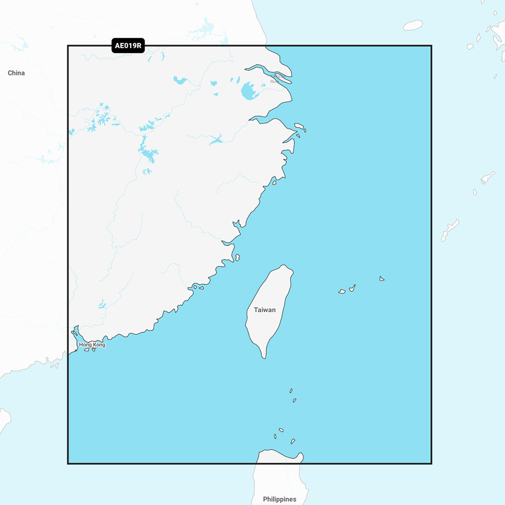
The Garmin Navionics Vision+ NVAE019R is a marine chart card providing detailed coastal coverage for Taiwan and portions of mainland China, including Shanghai, Hong Kong, Macau, Xiamen, and Guangzhou. This map solution offers integrated Garmin and Navionics content, featuring high-resolution depth range shading, 1-foot contours, and advanced navigation tools for boaters.
Key Features:
- Coverage includes coastal waters of Taiwan and mainland China from Shanghai to Hong Kong.
- Includes a one-year subscription for daily chart updates accessible via the ActiveCaptain app.
- Auto Guidance+ technology suggests dock-to-dock routing through channels and inlets.
- Detailed mapping includes high-resolution satellite imagery, aerial photography, and 3D perspectives including Fisheye and Marinereye views.
- Advanced depth tools feature up to 10 user-defined target depth ranges, shallow water shading, and dynamic lake level adjustments.
- Community-sourced content via ActiveCaptain provides POIs and local boater recommendations.
Technical Specifications:
- Format: MicroSD/SD card.
- Included in the box: SD/MSD map card.
Note: Auto Guidance+ technology is intended for planning purposes only and does not replace safe navigation practices. Please verify compatibility with your specific GPS chartplotter before use.
Product facts
- CT SKU
- CT-111743
- Model / MPN
- 010-C1217-00
- Package dimensions
- 2" X 4" X 6"
- Package weight
- 1.0 lb
Shipping & returns
Shipping & returns
Shipping methods, delivery estimates, and final costs appear at checkout before payment. Some bulky, supplier-shipped, or special-handling items may ship separately. See Shipping & Returns for return windows and eligibility.
Fit & compatibility
Fit & compatibility
Review the product title, description, images, dimensions, part numbers, and manufacturer details before purchase. For fit-sensitive items, confirm compatibility with your boat, RV, trailer, vehicle, or equipment.
Need help choosing?
Need help choosing?
Send us the product link or SKU, plus details about your boat, RV, trailer, vehicle, or project. We will help you narrow down the right option when product fit is not obvious.