Brand: Garmin
Garmin Navionics Vision+ Marine Chart NVAE020R - South China & Andaman Seas
Garmin Navionics Vision+ Marine Chart NVAE020R - South China & Andaman Seas
Sold out
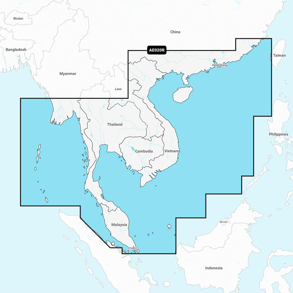
The Garmin Navionics Vision+ NVAE020R is a comprehensive marine charting solution covering the South China and Andaman Seas. This map provides detailed coastal coverage from Xiamen, China, to Thailand, including Vietnam, Cambodia, the Malay Peninsula, Hainan Island, and the Andaman and Nicobar Islands.
- Extensive Coverage: Includes detailed mapping of Hong Kong, Macau, Singapore, Phuket, Ho Chi Minh City, Guangzhou, and Xiamen.
- Advanced Mapping Features: Includes Auto Guidance+ technology for dock-to-dock routing, high-resolution depth range shading with up to 10 customizable targets, and shallow water shading.
- Detailed Imagery: Features high-resolution satellite imagery, aerial photography of ports and navigational landmarks, 3D Fisheye view, and 3D Marinereye view for both above and below waterline perspective.
- Up-to-date Data: Includes a one-year subscription for daily chart updates accessible via the ActiveCaptain app.
- Precision Contours: Offers up to 1' contours for enhanced navigation and fishing detail in harbors, marinas, and canals.
- Format: Delivered on a MicroSD/SD card.
Note: Auto Guidance+ is for planning purposes only and does not replace safe navigation operations. Please verify compatibility with your specific GPS chartplotter model before use.
Product facts
- CT SKU
- CT-111744
- Model / MPN
- 010-C1218-00
- Package dimensions
- 2" X 4" X 6"
- Package weight
- 1.0 lb
Shipping & returns
Shipping & returns
Shipping methods, delivery estimates, and final costs appear at checkout before payment. Some bulky, supplier-shipped, or special-handling items may ship separately. See Shipping & Returns for return windows and eligibility.
Fit & compatibility
Fit & compatibility
Review the product title, description, images, dimensions, part numbers, and manufacturer details before purchase. For fit-sensitive items, confirm compatibility with your boat, RV, trailer, vehicle, or equipment.
Need help choosing?
Need help choosing?
Send us the product link or SKU, plus details about your boat, RV, trailer, vehicle, or project. We will help you narrow down the right option when product fit is not obvious.