Brand: Garmin
Garmin Navionics Vision+ Marine Chart NVEU050R - Gulf of Finland & Riga
Garmin Navionics Vision+ Marine Chart NVEU050R - Gulf of Finland & Riga
Sold out
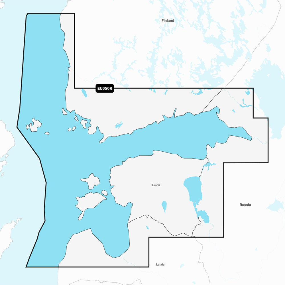
The Garmin Navionics Vision+ NVEU050R marine chart provides detailed, up-to-date cartography for the Gulf of Finland and the Gulf of Riga, covering areas from Åland to St. Petersburg, including Lakes Peipus and the Narva River. Designed for use with compatible chartplotters, this all-in-one map solution combines coastal and inland content with advanced navigational features.
- Coverage: Gulf of Finland (Åland to St. Petersburg), Gulf of Riga, Lake Peipus, and Narva River. Includes major ports such as Helsinki, Turku, Tallinn, Riga, and Vyborg.
- Advanced Navigation: Includes Auto Guidance+ technology for suggested dock-to-dock routing.
- Detailed Mapping: Features up to 1' contours for bottom structure detail, high-resolution satellite imagery, and aerial photography of ports, marinas, and landmarks.
- Visual Tools: Offers depth range shading (up to 10 user-defined ranges), shallow water shading, 3D Fisheye view, and 3D Marinereye view.
- Updates & Community: Includes a one-year subscription for daily chart updates via the ActiveCaptain app and access to community-sourced POIs.
- Format: Pre-programmed microSD/SD card.
Note: Auto Guidance+ is for planning purposes only and does not replace safe navigation practices. Please verify compatibility with your specific GPS chartplotter before purchase.
Product facts
- CT SKU
- CT-111880
- Model / MPN
- 010-C1249-00
- Package dimensions
- 1" X 1" X 6"
- Package weight
- 0.1 lb
Shipping & returns
Shipping & returns
Shipping methods, delivery estimates, and final costs appear at checkout before payment. Some bulky, supplier-shipped, or special-handling items may ship separately. See Shipping & Returns for return windows and eligibility.
Fit & compatibility
Fit & compatibility
Review the product title, description, images, dimensions, part numbers, and manufacturer details before purchase. For fit-sensitive items, confirm compatibility with your boat, RV, trailer, vehicle, or equipment.
Need help choosing?
Need help choosing?
Send us the product link or SKU, plus details about your boat, RV, trailer, vehicle, or project. We will help you narrow down the right option when product fit is not obvious.