Brand: Garmin
Garmin Navionics Vision+ NVEU074R Marine Chart - England, South Coast
Garmin Navionics Vision+ NVEU074R Marine Chart - England, South Coast
Sold out
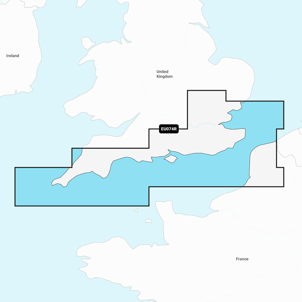
The Garmin Navionics Vision+ NVEU074R provides detailed marine mapping for the south coast of the UK, covering from Felixstowe to the Isles of Scilly, and the coast of France from Dunkirk to Le Treport. This comprehensive chart includes the River Thames to Windsor, the Isle of Wight, and major ports such as London, Dover, Portsmouth, Southampton, Plymouth, and Calais. Each purchase includes a one-year subscription for daily chart updates accessible via the ActiveCaptain app.
Key Features:
- Integrated coastal and inland mapping with Auto Guidance+ technology for suggested dock-to-dock routing.
- High-resolution depth range shading with up to 10 customizable target depth ranges.
- Detailed bottom structure depiction with up to 1' contours.
- Shallow water shading to identify and avoid hazards.
- Enhanced visual navigation tools including high-resolution satellite imagery, aerial photography, and 3D perspectives.
- 3D Fisheye and Marinereye views for detailed underwater and surface situational awareness.
- Access to the ActiveCaptain community for user-contributed POIs and local recommendations.
- Dynamic lake level adjustment functionality.
Technical Specifications:
- Format: MicroSD/SD card.
- Included in the box: SD/MSD card.
- Compatibility: Verify device compatibility with your specific GPS chartplotter before use.
Note: Auto Guidance+ technology is intended for planning purposes only and does not replace safe navigation practices.
Product facts
- CT SKU
- CT-111897
- Model / MPN
- 010-C1269-00
- Package dimensions
- 1" X 1" X 6"
- Package weight
- 0.1 lb
Shipping & returns
Shipping & returns
Shipping methods, delivery estimates, and final costs appear at checkout before payment. Some bulky, supplier-shipped, or special-handling items may ship separately. See Shipping & Returns for return windows and eligibility.
Fit & compatibility
Fit & compatibility
Review the product title, description, images, dimensions, part numbers, and manufacturer details before purchase. For fit-sensitive items, confirm compatibility with your boat, RV, trailer, vehicle, or equipment.
Need help choosing?
Need help choosing?
Send us the product link or SKU, plus details about your boat, RV, trailer, vehicle, or project. We will help you narrow down the right option when product fit is not obvious.