Brand: Garmin
Garmin Navionics Vision+ NVEU075R Marine Chart - Ireland, West Coast
Garmin Navionics Vision+ NVEU075R Marine Chart - Ireland, West Coast
Sold out
The Garmin Navionics Vision+ NVEU075R provides detailed marine cartography for the west coast of Ireland and surrounding inland waterways. This all-in-one map solution integrates comprehensive coastal and inland content, offering high-resolution mapping for boaters on compatible chartplotters.
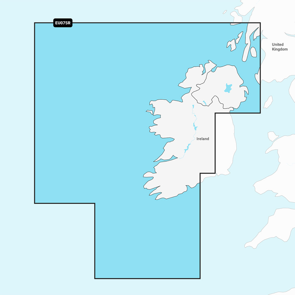
Coverage Area:
Coastal coverage of the north and western coasts of Ireland from Cork to Belfast, including the Shannon Inland and Shannon-Erne Waterways, Galway Bay, Lough Neagh, and the southwestern Scottish coast from Colonsay to Campbelltown.
Key Features:
- Includes a one-year subscription for daily chart updates via the ActiveCaptain app.
- Auto Guidance+ technology provides suggested dock-to-dock routing.
- Detailed bathymetry with up to 1' contours and user-defined shallow water shading.
- Depth range shading with up to 10 customizable target depth ranges.
- High-resolution satellite imagery and aerial photography of landmarks, ports, and marinas.
- 3D views including Fisheye view for underwater perspectives and Marinereye view for above-water surroundings.
- Dynamic lake level adjustments and community-sourced POIs via ActiveCaptain.
Technical Details:
- Format: MicroSD/SD card.
- Part Number: 010-C1233-00.
- Included in the box: SD/MSD card.
Auto Guidance+ is for planning purposes only and does not replace safe navigation operations. Please verify compatibility with your GPS chartplotter before use.
Product facts
- CT SKU
- CT-111758
- Model / MPN
- 010-C1233-00
- Package dimensions
- 1" X 1" X 6"
- Package weight
- 0.1 lb
Shipping & returns
Shipping & returns
Shipping methods, delivery estimates, and final costs appear at checkout before payment. Some bulky, supplier-shipped, or special-handling items may ship separately. See Shipping & Returns for return windows and eligibility.
Fit & compatibility
Fit & compatibility
Review the product title, description, images, dimensions, part numbers, and manufacturer details before purchase. For fit-sensitive items, confirm compatibility with your boat, RV, trailer, vehicle, or equipment.
Need help choosing?
Need help choosing?
Send us the product link or SKU, plus details about your boat, RV, trailer, vehicle, or project. We will help you narrow down the right option when product fit is not obvious.