Brand: Garmin
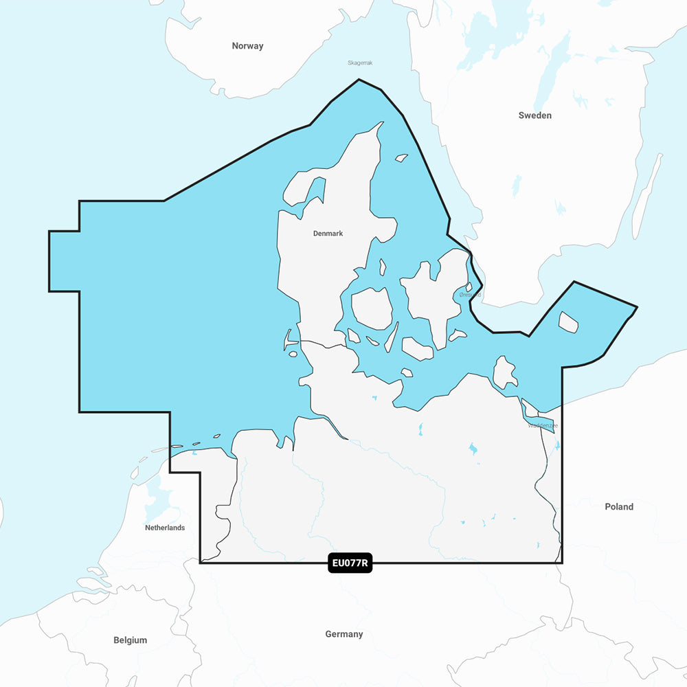
Garmin Navionics Vision+ Marine Chart NVEU077R - Denmark & Germany
Garmin Navionics Vision+ Marine Chart NVEU077R - Denmark & Germany
Sold out
The Garmin Navionics Vision+ NVEU077R marine chart provides detailed coastal coverage of Germany and Denmark, including the North Sea and Baltic Sea regions. Designed for compatible Garmin chartplotters, this all-in-one mapping solution offers advanced navigation features, high-resolution imagery, and integrated content to enhance situational awareness on the water.
Coverage Area:
- Covers North Sea and Baltic Sea coasts of Germany and Denmark
- Includes Kiel Canal, Szczecin Lagoon, River Elbe, Kattegat, and Bornholm Island
- Features detailed port data for Hamburg, Germany, and Copenhagen, Denmark
Key Features:
- Advanced Routing: Built-in Auto Guidance+ technology suggests dock-to-dock paths through channels, inlets, and marinas.
- Detailed Mapping: Includes up to 1-foot contours for precise bottom structure depiction.
- Enhanced Visuals: Features depth range shading, shallow water shading, and dynamic lake levels.
- Imagery and Views: Offers high-resolution satellite imagery, aerial photography of landmarks, 3D Fisheye view for underwater perspectives, and 3D Marinereye view for surroundings above and below the waterline.
- Community Data: Access to the ActiveCaptain community for POIs and local boater recommendations.
- Updates: Includes a one-year subscription for daily chart updates via the ActiveCaptain app.
Technical Specifications:
- Format: MicroSD/SD Card
- Model Number: 010-C1243-00
- Chart Code: NVEU077R
Note: Auto Guidance+ is intended for planning purposes only and does not replace safe navigation practices. Please verify compatibility with your specific GPS chartplotter before use.
Product facts
- CT SKU
- CT-111874
- Model / MPN
- 010-C1243-00
- Package dimensions
- 1" X 1" X 6"
- Package weight
- 0.1 lb
Shipping & returns
Shipping & returns
Shipping methods, delivery estimates, and final costs appear at checkout before payment. Some bulky, supplier-shipped, or special-handling items may ship separately. See Shipping & Returns for return windows and eligibility.
Fit & compatibility
Fit & compatibility
Review the product title, description, images, dimensions, part numbers, and manufacturer details before purchase. For fit-sensitive items, confirm compatibility with your boat, RV, trailer, vehicle, or equipment.
Need help choosing?
Need help choosing?
Send us the product link or SKU, plus details about your boat, RV, trailer, vehicle, or project. We will help you narrow down the right option when product fit is not obvious.