Brand: Garmin
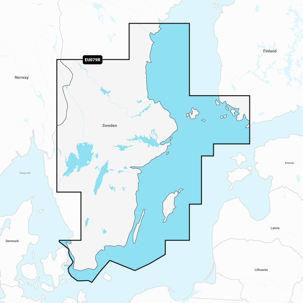
Garmin Navionics Vision+ Marine Chart NVEU079R - Sweden, Southeast
Garmin Navionics Vision+ Marine Chart NVEU079R - Sweden, Southeast
Sold out
The Garmin Navionics Vision+ marine chart (NVEU079R) offers comprehensive, high-detail mapping for the southeast coast of Sweden and surrounding areas. This all-in-one solution integrates Garmin and Navionics content, providing boaters with essential data for coastal navigation, lakes, and rivers, including high-resolution satellite imagery and detailed aerial photography of ports and navigational landmarks.
Coverage Area
Detailed coverage spans the south and east coasts of Sweden from Helsingborg to Sundsvall, including cities such as Trelleborg, Nyköping, Stockholm, Norrtälje, and Karlsborg. It extends to the southwest tip of Finland (including Turku) and includes islands such as Öland, Gotland, and Åland. Inland coverage features major lakes including Vänern, Vättern, Sommen, Siljan, Runn, Fryken, and Helgasjön, along with the Göta and Strömsholms canals.
Key Features
- One-year subscription included for daily chart updates via the ActiveCaptain app.
- Auto Guidance+ technology for automated dock-to-dock routing suggestions.
- High-resolution depth range shading with up to 10 customizable target depth ranges.
- Up to 1' contours for detailed visibility of bottom structures.
- Shallow water shading to identify and avoid hazards.
- 3D views including Fisheye for underwater contours and Marinereye for above and below waterline perspectives.
- Dynamic lake level adjustments for real-time accessibility planning.
- Access to ActiveCaptain community-sourced POIs.
Technical Specifications
- Format: MicroSD/SD Card.
- Note: Auto Guidance+ is for planning purposes only and does not replace safe navigation operations.
- Compatibility: Please verify compatibility with your specific GPS chartplotter prior to purchase.
Product facts
- CT SKU
- CT-111878
- Model / MPN
- 010-C1247-00
- Package dimensions
- 1" X 1" X 6"
- Package weight
- 0.1 lb
Shipping & returns
Shipping & returns
Shipping methods, delivery estimates, and final costs appear at checkout before payment. Some bulky, supplier-shipped, or special-handling items may ship separately. See Shipping & Returns for return windows and eligibility.
Fit & compatibility
Fit & compatibility
Review the product title, description, images, dimensions, part numbers, and manufacturer details before purchase. For fit-sensitive items, confirm compatibility with your boat, RV, trailer, vehicle, or equipment.
Need help choosing?
Need help choosing?
Send us the product link or SKU, plus details about your boat, RV, trailer, vehicle, or project. We will help you narrow down the right option when product fit is not obvious.