Brand: Garmin
Garmin Navionics Vision+ NVEU620L Greenland & Iceland Cartography Map Card
Garmin Navionics Vision+ NVEU620L Greenland & Iceland Cartography Map Card
Sold out
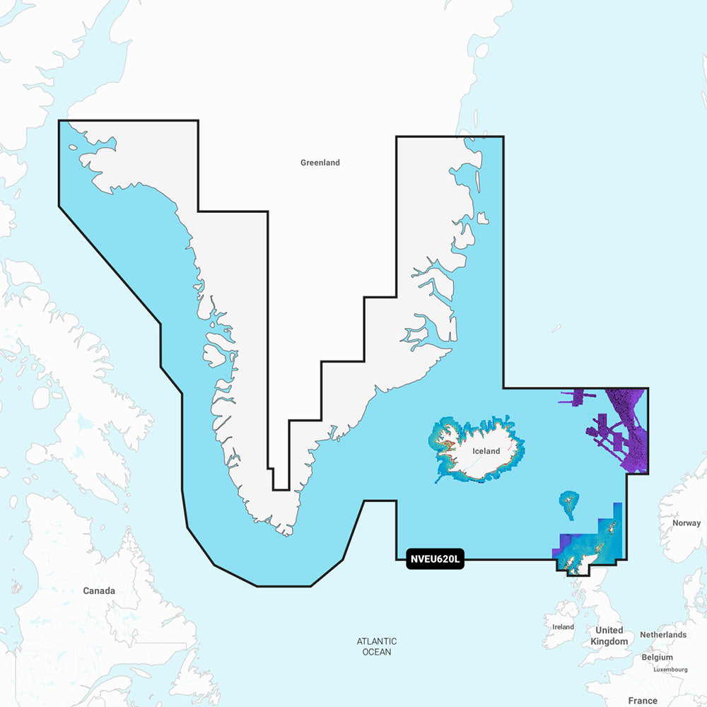
This Garmin Navionics Vision+ NVEU620L marine mapping card provides comprehensive coastal and inland chart data for Greenland, Iceland, the Faeroe Islands, and parts of the United Kingdom including the Shetland and Orkney Islands. Designed for compatible chartplotters, this all-in-one solution features integrated Garmin and Navionics content, including detailed depth contours and advanced navigation tools.
Key Features:
- Includes a one-year subscription for daily chart updates via the ActiveCaptain app.
- Auto Guidance+ technology provides suggested dock-to-dock routing through channels and inlets.
- High-resolution relief shading and satellite imagery improve situational awareness.
- Detailed depth range shading allows you to highlight up to 10 target depth ranges.
- Up to 1' contours provide a precise depiction of bottom structures.
- Includes 3D views: Fisheye View for underwater perspectives and Marinereye View for surrounding surface areas.
- Supports shallow water shading to help avoid hazards at user-defined depths.
- Provides aerial photography of ports, marinas, and navigational landmarks.
- Compatible with Dynamic Lake Level adjustments.
- Access to the ActiveCaptain community for local POIs and boater recommendations.
Specifications:
- Coverage Area: Greenland, Iceland, Faeroe Islands, Shetland Islands, Orkney Islands, and northern Britain.
- Format: MicroSD/SD card.
- Part Number: 010-C1270-00.
- Included: 1 MicroSD/SD map card.
Note: Auto Guidance+ is intended for planning purposes only and does not replace safe navigation practices. Raster cartography is not supported on ECHOMAP CHIRP and ECHOMAP Plus series, though it can be viewed on mobile devices via the ActiveCaptain app. Please verify compatibility with your specific GPS chartplotter before purchase.
Product facts
- CT SKU
- CT-113347
- Model / MPN
- 010-C1270-00
- Package dimensions
- 1" X 4" X 6"
- Package weight
- 0.15 lb
Shipping & returns
Shipping & returns
Shipping methods, delivery estimates, and final costs appear at checkout before payment. Some bulky, supplier-shipped, or special-handling items may ship separately. See Shipping & Returns for return windows and eligibility.
Fit & compatibility
Fit & compatibility
Review the product title, description, images, dimensions, part numbers, and manufacturer details before purchase. For fit-sensitive items, confirm compatibility with your boat, RV, trailer, vehicle, or equipment.
Need help choosing?
Need help choosing?
Send us the product link or SKU, plus details about your boat, RV, trailer, vehicle, or project. We will help you narrow down the right option when product fit is not obvious.