Brand: Garmin
Garmin Navionics Vision+ NVEU644L Baltic Sea Marine Mapping Card
Garmin Navionics Vision+ NVEU644L Baltic Sea Marine Mapping Card
Sold out
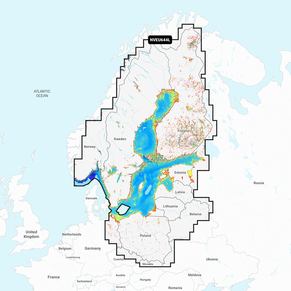
The Garmin Navionics Vision+ NVEU644L provides detailed marine mapping for the Baltic Sea and surrounding lakes in Scandinavia and Poland. Designed for use with compatible GPS chartplotters, this all-in-one cartography solution combines coastal and inland map content with advanced navigation and fishing features. Includes a one-year subscription for daily chart updates via the ActiveCaptain app.
Coverage Area
Detailed coverage includes the Gulfs of Bothnia, Finland, and Riga; the Masurian Lakes; the Szczecin Lagoon; Lake Peipus; and various lakes across Norway, Sweden, and Finland. Major ports covered include Oslo, Stockholm, Helsinki, St. Petersburg, Gdansk, and Kaliningrad.
Key Features
- Auto Guidance+ technology for automated dock-to-dock routing.
- High-resolution depth range shading with up to 10 customizable target depth ranges.
- Up to 1' contours for detailed bottom structure depiction.
- Shallow water shading to assist with navigation.
- High-resolution relief shading, satellite imagery, and aerial photography for enhanced situational awareness.
- 3D views, including Fisheye and Marinereye, for underwater and surrounding area visualization.
- Dynamic lake level adjustments for current water conditions.
- Access to the ActiveCaptain community for local POI recommendations.
Technical Specifications
- Format: MicroSD/SD card.
- Compatibility: Verify chartplotter compatibility with Garmin Navionics+ content prior to purchase.
- Includes: SD/MSD map card.
Note: Auto Guidance+ is intended for planning purposes only and does not replace safe navigation practices. Raster cartography is not viewable on ECHOMAP CHIRP and ECHOMAP Plus models.
Product facts
- CT SKU
- CT-113350
- Model / MPN
- 010-C1273-00
- Package dimensions
- 1" X 4" X 6"
- Package weight
- 0.15 lb
Shipping & returns
Shipping & returns
Shipping methods, delivery estimates, and final costs appear at checkout before payment. Some bulky, supplier-shipped, or special-handling items may ship separately. See Shipping & Returns for return windows and eligibility.
Fit & compatibility
Fit & compatibility
Review the product title, description, images, dimensions, part numbers, and manufacturer details before purchase. For fit-sensitive items, confirm compatibility with your boat, RV, trailer, vehicle, or equipment.
Need help choosing?
Need help choosing?
Send us the product link or SKU, plus details about your boat, RV, trailer, vehicle, or project. We will help you narrow down the right option when product fit is not obvious.