Brand: Garmin
Garmin Navionics Vision+ NVEU645L Skagerrak & Kattegat Marine Map
Garmin Navionics Vision+ NVEU645L Skagerrak & Kattegat Marine Map
Sold out
The Garmin Navionics Vision+ NVEU645L Skagerrak & Kattegat is an all-in-one marine mapping solution for compatible chartplotters. It provides comprehensive coastal and inland coverage with a detailed Navionics style color palette, high-resolution shading, and advanced navigation tools.
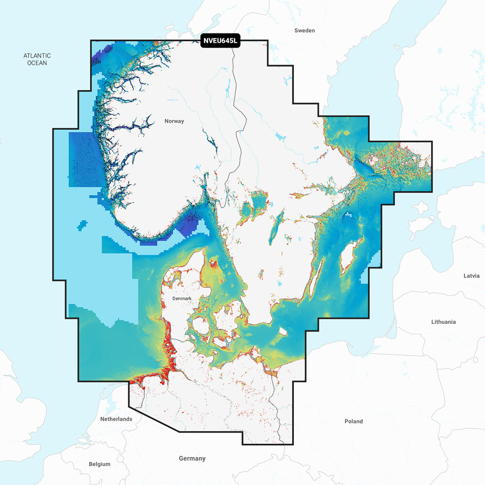
Coverage Area:
This chart includes detailed coverage of the Skagerrak and Kattegat and their approaches. It covers the Scandinavian coast from Kristiansund, Norway, to Gavle, Sweden; the Aland Islands; Turku, Finland; Gotland and Bornholm Islands; Szczecin Lagoon; the Kiel Canal; and all of Denmark. Key ports include Oslo, Malmo, Stockholm, Copenhagen, Aarhus, and Hamburg. It also includes various lakes in Sweden and Norway, such as Lake Vanern, Lake Vattern, Lake Mjosa, and the Telemark Canal.
Features:
- Includes a one-year subscription for daily chart updates via the ActiveCaptain app.
- Auto Guidance+ technology suggests dock-to-dock paths through channels, inlets, and marinas.
- High-resolution depth range shading with up to 10 user-selectable target depth ranges.
- Detailed 1' contours for enhanced depiction of bottom structure in harbors, marinas, canals, and swamps.
- Shallow water shading for improved awareness of navigation hazards.
- High-resolution relief shading, satellite imagery, and aerial photography for superior situational awareness.
- 3D views including Fisheye View (underwater representation) and Marinereye View (above and below waterline).
- Dynamic Lake Level adjustment for checking accessibility based on current water levels.
- Access to the ActiveCaptain community for user-sourced POIs and local recommendations.
- Format: MicroSD/SD card.
Note: Auto Guidance+ is for planning purposes only and does not replace safe navigation operations. Raster cartography is not viewable on echoMAP CHIRP and ECHOMAP Plus combos but can be viewed on mobile devices via the ActiveCaptain app.
Product facts
- CT SKU
- CT-113351
- Model / MPN
- 010-C1274-00
- Package dimensions
- 1" X 4" X 6"
- Package weight
- 0.15 lb
Shipping & returns
Shipping & returns
Shipping methods, delivery estimates, and final costs appear at checkout before payment. Some bulky, supplier-shipped, or special-handling items may ship separately. See Shipping & Returns for return windows and eligibility.
Fit & compatibility
Fit & compatibility
Review the product title, description, images, dimensions, part numbers, and manufacturer details before purchase. For fit-sensitive items, confirm compatibility with your boat, RV, trailer, vehicle, or equipment.
Need help choosing?
Need help choosing?
Send us the product link or SKU, plus details about your boat, RV, trailer, vehicle, or project. We will help you narrow down the right option when product fit is not obvious.