Brand: Garmin
Garmin Navionics Vision+ NVEU646L Chart Card, Europe Central & West
Garmin Navionics Vision+ NVEU646L Chart Card, Europe Central & West
Sold out
The Garmin Navionics Vision+ NVEU646L provides detailed marine mapping for Central and Western Europe, featuring combined coastal and inland content for your compatible chartplotter. This all-in-one cartography solution includes a one-year subscription for daily chart updates via the ActiveCaptain app.
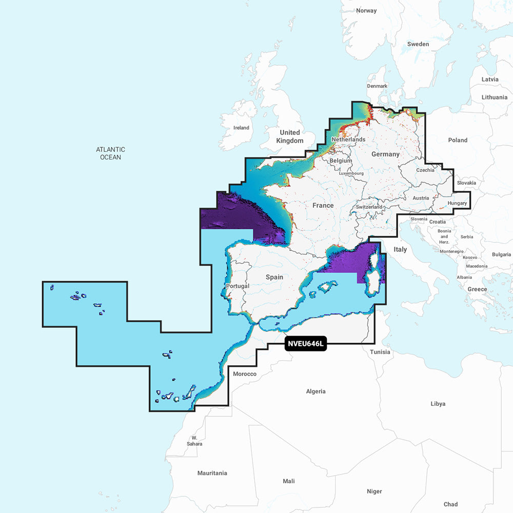
Coverage Area:
- Covers the European coast from Szczecin Lagoon to Monaco, the Azores, Madeira, the Canary Islands, the Balearics, Corsica, Sardinia, Gibraltar, and the English Channel.
- Includes the Channel Islands, IJsselmeer, and major rivers across France, Germany, and the Low Countries.
- Features coverage for Lakes Maggiore, Como, Garda, Geneva, Constance, and Balaton.
Key Features:
- Auto Guidance+ technology for suggested dock-to-dock routing.
- High-resolution relief shading, satellite imagery, and aerial photography for enhanced situational awareness.
- Detailed bottom structure views with up to 1' contours and 3D Fisheye and Marinereye views.
- Depth range shading with up to 10 user-selectable color ranges and shallow water shading.
- Access to the ActiveCaptain community for local POIs and boater recommendations.
- Dynamic lake level adjustment.
- Format: MicroSD/SD card.
Note: Auto Guidance+ is for planning purposes only and does not replace safe navigation operations. Raster cartography cannot be viewed on echoMAP CHIRP and ECHOMAP Plus combos, but can be viewed on mobile devices via the ActiveCaptain app.
Product facts
- CT SKU
- CT-113352
- Model / MPN
- 010-C1275-00
- Package dimensions
- 1" X 4" X 6"
- Package weight
- 0.15 lb
Shipping & returns
Shipping & returns
Shipping methods, delivery estimates, and final costs appear at checkout before payment. Some bulky, supplier-shipped, or special-handling items may ship separately. See Shipping & Returns for return windows and eligibility.
Fit & compatibility
Fit & compatibility
Review the product title, description, images, dimensions, part numbers, and manufacturer details before purchase. For fit-sensitive items, confirm compatibility with your boat, RV, trailer, vehicle, or equipment.
Need help choosing?
Need help choosing?
Send us the product link or SKU, plus details about your boat, RV, trailer, vehicle, or project. We will help you narrow down the right option when product fit is not obvious.