Brand: Raymarine
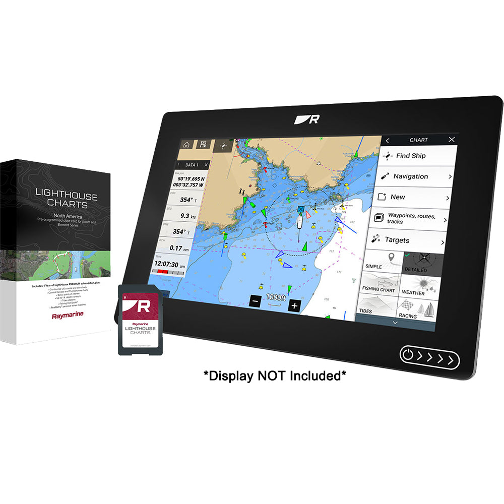
Raymarine LightHouse Chart North America (R70794)
Raymarine LightHouse Chart North America (R70794)
10+ available
The Raymarine LightHouse Chart North America provides comprehensive marine navigation coverage for the contiguous United States, Alaska, Hawaii, the Bahamas, and extensive inland freshwater bodies. It also includes coverage for the Great Lakes, British Columbia, the St. Lawrence River, and the Atlantic coastlines of Newfoundland, Nova Scotia, Prince Edward Island, and New Brunswick.
These charts are developed from official hydrographic sources to ensure readability and navigational control. Key features include:
- Four customizable color palettes for various lighting conditions.
- Adjustable chart symbol controls for personalized display preferences.
- Includes high-resolution map data for effective marine navigation.
Technical Requirements: This product requires the Axiom display to run the latest operating system. Specifically, LightHouse Fremantle 3 software or newer is required to operate LightHouse Charts North America. A LightHouse PREMIUM annual subscription is available separately to provide regular updates, enhanced points of interest, and high-resolution satellite imagery.
Product facts
- CT SKU
- CT-110817
- Model / MPN
- R70794
- UPC / GTIN
- 723193837214
- Package dimensions
- 1" X 4" X 5"
- Package weight
- 0.09 lb
Shipping & returns
Shipping & returns
Shipping methods, delivery estimates, and final costs appear at checkout before payment. Some bulky, supplier-shipped, or special-handling items may ship separately. See Shipping & Returns for return windows and eligibility.
Fit & compatibility
Fit & compatibility
Review the product title, description, images, dimensions, part numbers, and manufacturer details before purchase. For fit-sensitive items, confirm compatibility with your boat, RV, trailer, vehicle, or equipment.
Need help choosing?
Need help choosing?
Send us the product link or SKU, plus details about your boat, RV, trailer, vehicle, or project. We will help you narrow down the right option when product fit is not obvious.